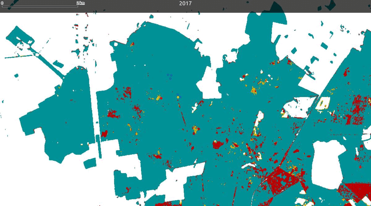
Collection of maps detecting oak decline based on Sentinel-2 images using the RECONFORT Oak module.
This is a 3-class classification according to the DEPERIS protocol: “healthy” pixel (DEPERIS score between 0 and 20%), “moderately declining” (score between 20% and 50%) and “severely declining” (between 50 and 100%). It includes both the 3-class maps and continuous score maps from 2017 to 2024, corresponding to public deciduous forests (OSO mask).
Software: The source code for the RECONFORT module is available on
Framagit.
Source Data: This product is derived from Sentinel-2 L2A Surface Reflectance data (
Theia).
Associated Publication: For more details, please refer to the associated scientific publication
Mouret & al., 2024[1].
Recommended usage: products can also be visualized and accessed in Python without downloading, via the following STAC catalog:
https://browser-theia.stac.teledetection.fr/.
Products can also be visualized in QGIS by following the instructions provided in the CDS Theia Montpellier catalog or by directly adding XYZ tiles.